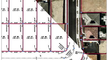
The aerial overlay places the subdivision map on top of an aerial photograph, showing how the planned lots and streets align with the actual land on the ground. The link…
2 results
The aerial overlay places the subdivision map on top of an aerial photograph, showing how the planned lots and streets align with the actual land on the ground. The link…
The County Surveyor was one of more than 180 organizations honored during the Special Achievement in GIS (SAG) Awards ceremony on July 10 at the annual Esri International User Conference…