

Every day, residents, businesses and public agencies rely on accurate property records to support essential services across San Bernardino County. From home construction and business development to emergency response planning and infrastructure projects, parcel information helps power many of the systems that keep communities moving.
To better support those services now and into the future, the county recently completed a major modernization effort that upgrades how parcel data is managed across more than 820,000 parcels countywide.
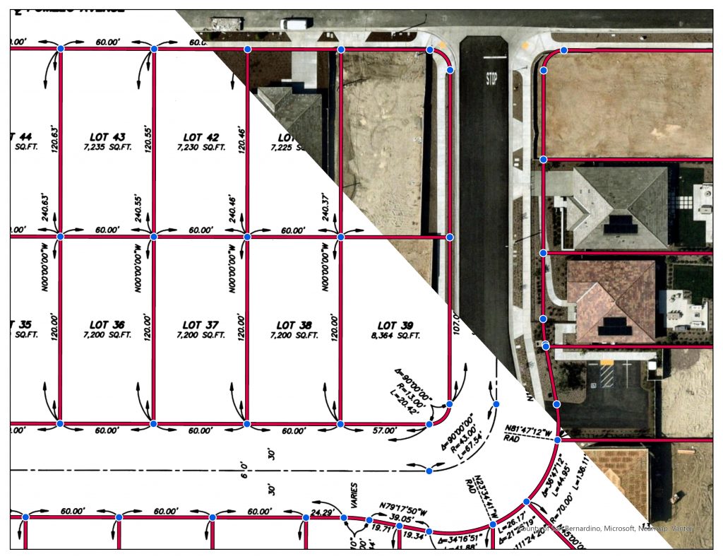
Led by the San Bernardino County Innovation and Technology Department in collaboration with the San Bernardino County Assessor-Recorder-County Clerk and the San Bernardino County Public Works Department – County Surveyor, the project transitioned decades of parcel records into a modern geographic information system platform known as Parcel Fabric.
Developed by Esri, the new parcel fabric system creates a unified countywide framework for managing parcel boundaries, assessor maps and land records within a single integrated environment.
“This project brings all parcel data into one cohesive system, creating a single, countywide view from boundary to boundary,” said Innovation and Technology Department Deputy Chief Steven Raughley. “It replaces fragmented records with a modern platform that improves how we maintain and validate critical land information.”
A collaborative modernization effort
San Bernardino County has digitally maintained parcel data for many years, reflecting a long-standing investment in land records management. As technology and service needs evolved, the county launched an effort to modernize the system further and strengthen efficiency, coordination and long-term reliability.
Because parcel data serves as the foundation for many county services that residents rely on every day, the modernization effort brought together departments responsible for land records, mapping accuracy and technology infrastructure. The Assessor-Recorder-County Clerk’s office oversees official parcel and assessor mapping records that support property ownership, taxation and public access to land information. The County Surveyor’s office within Public Works provides surveying and mapping expertise essential to maintaining accurate parcel boundaries and land records, while the Innovation and Technology Department coordinated the technical implementation and integration of the new platform.
Working alongside Esri, county teams converted and validated more than 21,000 assessor map pages and associated parcel records before the system became fully operational.
“This was a true team effort,” Raughley said. “Staff across multiple departments worked together over an extended period to plan, execute and validate the system. That level of coordination was critical to delivering a successful outcome.”
Faster service for residents and businesses
Although much of the modernization work happened behind the scenes, the benefits directly support residents, businesses and developers who rely on accurate parcel information every day.
The upgraded system supports more efficient parcel processing and improves coordination between departments that use parcel data for permitting, planning, infrastructure projects and emergency response operations.
For residents and businesses, that means projects tied to parcel information — including home improvements, commercial development and housing construction — can move through key processes more efficiently.
“Today’s land development world is all computer-based,” said County Surveyor Ryan Hunsicker. “The computer system relies on accurate parcel information, and now we’re able to update that data much more quickly for our residents and business community.”
Hunsicker said the modernization strengthens the reliability of parcel information used throughout county operations and supports better long-term planning across departments.
“We have improved coordination between departments, fewer errors, and improved reliability of the parcel information that supports better planning, emergency response, permitting and public works projects,” Hunsicker said.
The new platform also supports more consistent updates to assessor maps and parcel records, helping staff provide more timely information to the public.
“If we’re able to get parcel information updated as soon as possible, we’re providing more timely service to the public,” said Xiclaly Magdaleno, a mapping specialist with the ARC’s Map Unit. “We want to be transparent about our workflow, and now we’re in a much better position to deliver on that.”
Building a foundation for the future
Beyond improving day-to-day operations, the modernization positions San Bernardino County for continued innovation and long-term success.
The platform captures parcel history over time, supporting stronger record management and long-term transparency. It also allows staff to train on modern industry-standard GIS tools, helping strengthen workforce development and future recruitment efforts.
“With the new system, we can provide structured learning and skill-building opportunities, allowing users to develop and enhance their GIS capabilities,” Magdaleno said.
The Parcel Fabric system is now fully operational and used daily by county staff across departments, providing a stronger foundation for land records management and the services residents, businesses and developers rely on throughout the county.
“A modern, reliable parcel system strengthens the foundation for countless county services,” Hunsicker said. “This project helps ensure we can continue providing accurate information and responsive service for the communities we serve.”
Additional County Update News – May 14, 2026
- Southern California Edison wildfire safety community meetings
- Targeted Crime Suppression-Operation Consequences; 14 arrests, 13 firearms seized
- Residents encouraged to use new mapping tool to help shape truck routes
- Aging and Adult Services – Public Guardian celebrates Older Americans Month: Champion Your Health
- County to host SBC LevelUP Live FAQ Session on May 21
- Applications now being accepted for the San Bernardino County Civil Grand Jury
- Regional Parks announces extended hours for summertime activities
- SBC Through Your Eyes: Pacific Crest Trail
- Submit your photos and videos of the county’s destinations, nature and cityscapes
- San Bernardino County history: The first vehicle in the county
- Things to do in San Bernardino County
- Pet of the Week: Stacy